

North America, 1776: an Annotated Atlas
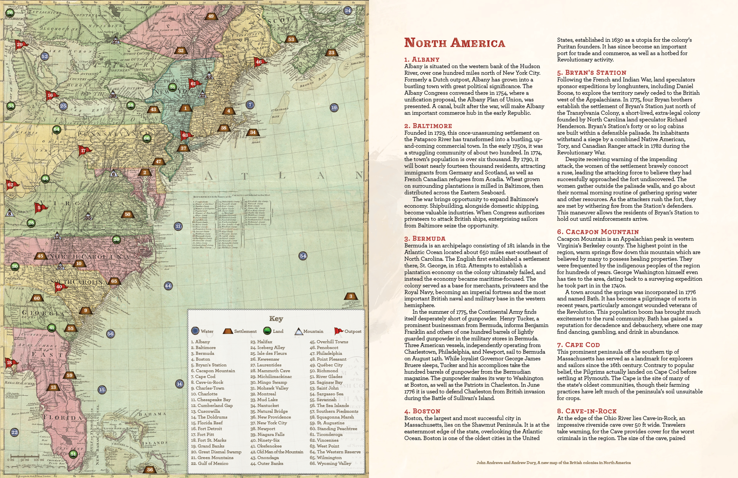
This map of North America (made by a surveyor in 1777) includes the rebellious Thirteen Colonies, the loyalist Canadian territories of Rupert's Land, Quebec, Labrador, Newfoundland, and Nova Scotia, the Ohio Country and indigenous lands over the Appalachian Mountains, and British holdings in East and West Florida, the Bahamas, and Bermuda.
Original map titled "A new map of the British colonies in North America, shewing the seat of the present war, taken from the best surveys, compared with and improved from manuscripts of several noblemen and gentlemen," created by John Andrews. Annotations and rollable tables were made by the Flagbearer Games team, mixing general information and story hooks + specific details on points of interest. Here’s a GMBinder Link to download these pages in full.