A full-color cloth map of the occupied city of Boston, under siege by patriot forces under the command of George Washington. This depiction by an American loyalist includes annotations intended for the British army and their allies.
This large 35 × 26.5 inch cloth map is printed on a crease-resistant cotton-polyester blend. The map makes a great wall hanging and serves as a companion piece to the adventure campaign in The American Crisis: War in the North; where players help defend Bunker Hill and thwart the British stalemate at the Siege of Boston. The fabric is machine washable and iron-safe on low heat settings.
Original document titled "A plan of Boston in New England with its environs, including Milton, Dorchester, Roxbury, Brooklin, Cambridge, Medford, Charlestown, parts of Malden and Chelsea with the military works constructed in those places in the years 1775 and 1776," created by Henry Pelham and Francis Jukes.
All purchases come with a QR code link to download the Colonial Gazette PDF, including a 4-page annotated version of this map with additional information about the city’s history, inhabitants, and role in the American Revolution.
This design is sourced from a historical artifact which contains blemishes and imperfections, painstakingly restored and upsampled. The printing process transfers this image onto blended fabric using eco-friendly, water-based inks. Cloth map is cut and hemmed by hand and may experience minor shrinkage.


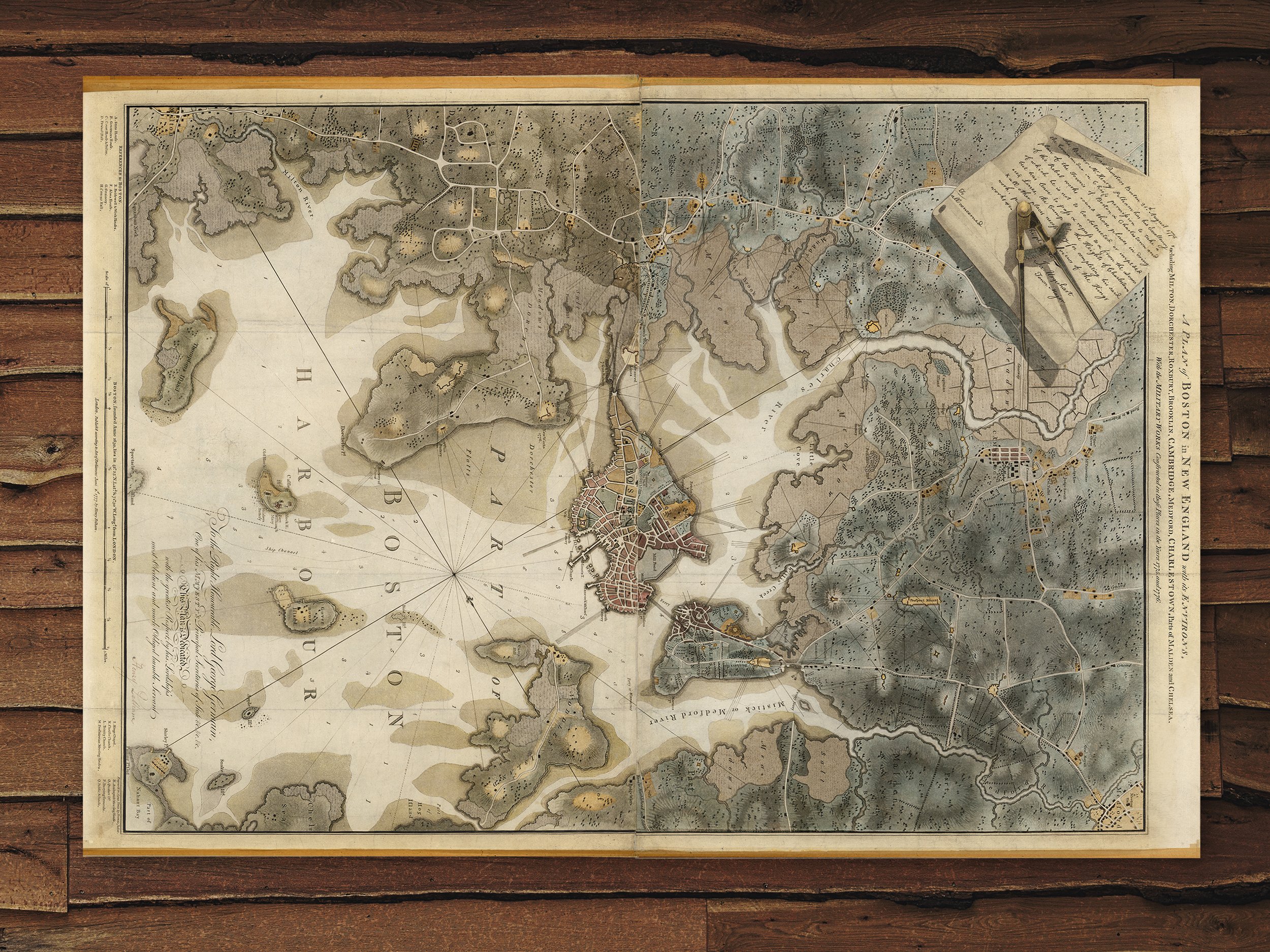 Image 1 of 5
 Image 2 of 5
 Image 3 of 5
 Image 4 of 5
 Image 5 of 5